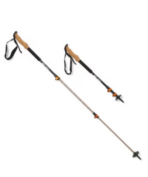
These hiking poles are sturdy, and great to help keep your balance on short or longer hikes
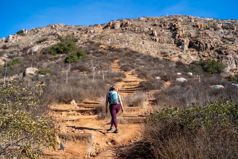
South Fortuna Peak is the lowest of the five main peaks in the Mission Trails Regional Park in San Diego, topping out at 1094 ft. Despite being the lowest peak, the South Fortuna Mountain trail is a very popular workout trail for local hikers. This trail is known for its imposing set of wooden stairs, nicknamed “Stairway to Heaven,” leading up to the peak of the South Fortuna Mountain. Besides being a great workout trail, South Fortuna Mountain has one of the best views of the San Diego area. On a clear day, you could see from Mexico to Catalina Island.

Mission Trails Clairemont Mesa Trailhead
Clairemont Mesa Blvd, San Diego, CA 92124
32.825246, -117.076591
There is a big dirt lot in front of the trailhead. The parking area opens from sunrise to sunset. There is also street parking if you plan to come earlier or stay later than the opening hours.
Free
There aren’t any restrooms at either trailhead.
Pets are allowed, but they must be leashed at all times.
4.8 mi Loop
1,099 ft
Moderate to Difficult
Takes an average 2-4 hours
You can do this hike year-round. However, it is more beautiful in the spring when there are wildflowers. In the summer, make sure to start early as there aren’t any shades on the trail.
There are multiple entrances and trail combinations to hike to the peak of South Fortuna Mountain, some are more difficult than others. The 3 main routes are: the Oak Canyon Trail near the Old Mission Dam, off the Jackson Road stage area, and the Tierrasanta Entrance at the end of Clairemont Mesa Blvd. Although the entrance from the Jackson Road stage area is more popular, it crosses over a river that might be unpassable if there had been big rainfalls recently. All parking lots in Mission Trails Regional Park close from sunset to sunrise. For this reason, we prefer the Tierrasanta Entrance because there are street parking options if we finish the trail later than the closing time. In this blog, we’ll show you the whole loop for the South Fortuna Mountain peak starting from the Tierrasanta Entrance.
Mission Trails Regional Park has about 60 miles of interconnecting trails. So, it can be confusing when finding your way around. We recommend using a tracking app such as AllTrails. If you have Alltrails +, you can download the offline map, which we found very helpful!
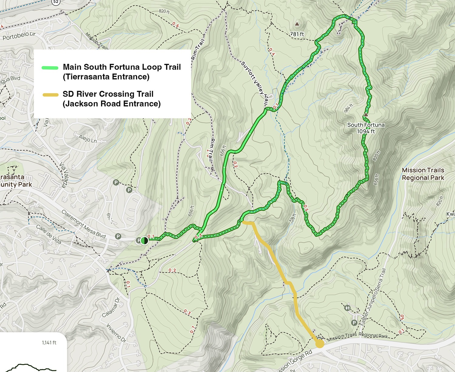
The Tierrasanta Entrance for Mission Trails Regional Park is at the end of Clairemont Mesa Blvd, off Interstate 15. There is a big gravel lot for parking. This lot is closed from sunset to sunrise. If you plan to come earlier or stay later than the opening hours, there are tons of street parking.
The trailhead for South Fortuna Mountain is located at the end of the big gravel lot, where the wooden bridge is. This wooden bridge has some sway to it, especially when we get to the middle. Once we crossed the bridge, there was a gravel path leading uphill. There is also a trail map and a big wooden sign here. We stayed left to follow the trail to a wide gravel path.
About a few hundred feet in, we turned right to follow the small, single-track trail. This is the Clairemont Mesa trail section. You’ll want to follow signs toward the Fortuna Saddle Trail West. This section of the single track is narrow and more rugged. There are wooden steps as the trail descends briefly, then climbs back up.
At about 0.2 miles, we reached another gravel road. This is the start of our South Fortuna Mountain trail loop. This section of the trail is the Fortuna Saddle Trail West. Going left (clockwise), you’ll be climbing down the steep “Stairway to Heaven,” while going right (counter-clockwise), you’ll have to climb up the stairs. My knees had been hurting since the Duck Lake Trail, so we preferred going up the stairs. Therefore, we turned right onto this gravel road.
After a short distance along the gravelly road, we came upon another junction. Here, we made a hard left and followed the trail to descend. By the way, make sure to keep an eye out for mountain bikers. This area is very popular for mountain biking. Around 0.75 miles in, there is an intersection for the San Diego River Crossing Trail. If you’re coming from the Jackson staging area entrance, this is where you’ll start your loop to South Fortuna Mountain Peak. As for us, we continued on our way for a bit further until we reached the fork for the Suycott Valley Trail on the right.
This section of the Suycott Valley Trail on the South Fortuna Mountain Loop trail is narrow and rocky. The trail winds its way down a steep and rocky hill. At about 0.3 miles, the trail opened up to a flat area. Here, we went right for a short distance to reach the junction for South Fortuna Trail. If you go straight to the flat area, you’ll go to the Suycott Wash Service Road.
The South Fortuna Trail is on the right-hand side. This is where the trail difficulty increases. From here, it is about 1.2 miles to the summit. The South Fortuna trail starts out easy as it meanders between the tall oak trees and willows before crossing a small wooden bridge. After about 500ft, we came to another junction, which we turned right to keep going. I know, this trail has A LOT of turns!! That offline map from Alltrails is very helpful.
From here, the trail gets steeper and steeper. It also got rockier and more rugged. Make sure to wear hiking shoes with good traction! You’ll need them. As we climbed higher, the views also became more beautiful. In the distance, we could see the popular wooden stairs. These stairs are steep and relentless. They pretty much go straight up the side of the small mountain. Most of the stairs are in good shape, with a few broken ones. If your glute hasn’t suffered enough through the earlier climb, it will after you finish climbing these stairs. Make sure to take your time and watch your steps. You don’t want to slip here.
About ⅔ through the stair section, the trail left around the rocky area. It can get confusing here, but as long as you stay left, you’ll find the maintained trail again. There is a small overlook here for a quick break to enjoy the views of the San Diego River Gorge below and the downtown skyline in the distance.
After this rocky section, there were more stairs for us to climb. At the top of the stairs, there is a sign pointing toward the left for the South Fortuna trail. From here, it is another 0.4 miles uphill before we reach a small side trail on the right to the actual summit of South Fortuna Mountain. The summit of South Fortuna Mountain is a bit anti-climactic, especially after the views from the stairs. However, there is a cool marker here so you can take your summit photo.
Once we were done taking our summit photo, we turned back and continued to finish our South Fortuna Loop. The trail led down a steep, rocky path toward the saddle. After about 0.6 miles, we came to our first electrical tower sighting. From here, we crossed underneath the powerlines and turned left to follow the wide dirt trail. If you’re coming up from Oak Canyon Trail, this is where the trails will meet up. There is another intersection here. Going right leads up to the North Fortuna summit. Going left to go back to the car.
We followed the dirt road to make our way back to the car. It is a steep descent back down toward the valley floor. There are a couple of off-shoot trails along the way, but they all end up in the same place. So, we decided to stay on the main Fortuna Saddle Trail, the wide dirt trail that ran along the power lines.
At about 3.7 miles, the trail gained back some of its elevation. It was quite a steep climb, especially when you’re already tired. The good news is that once you reach the top of this short climb, it is an easy walk to the junction of the Clairemont Mesa trail, where the South Fortuna Mountain Trail loop begins. From here, we went right to weave through the narrow Clairemont Mesa trail before crossing over the wooden bridge at the trailhead.
This South Fortuna Mountain Trail is a lot more challenging and fun than we expected. Another fun hike in the area you should check out is Cowles Mountain. It is a lot shorter but also has amazing views of the San Diego area. If you prefer a longer hike, check out Iron Mountain. For easier hikes with waterfalls, we love the Los Penasquitos Canyon Trail. It is long but mostly flat, and you’ll get a wonderful view of the canyon. However, our favorite is the Potato Chip Hike. It is very popular and worth it!
Happy Adventuring. Don’t forget to check out the related posts below for more inspiration on your upcoming adventures. While at it, follow us on Instagram and subscribe to our YouTube channel! We’ll love you forever!
These are the gear that we personally use and find helpful for this particular adventure. Don’t forget to check out our Recommended Gear section as well.

These hiking poles are sturdy, and great to help keep your balance on short or longer hikes

If you tend to have foot blisters on hikes, get this! We use this all the time.

Our favorite hiking/travel jacket. It's warm and packable, perfect to bring on a hike or a road trip.
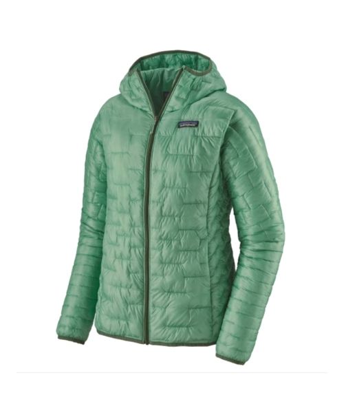
Our favorite hiking/travel jacket. It's warm and packable, perfect to bring on a hike or a road trip.

This jacket is packable into a super small and light little ball. Perfect for when you just need a little…
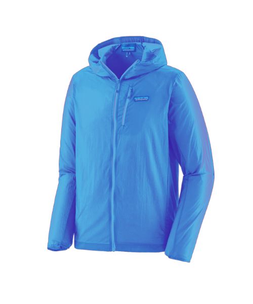
This jacket is packable into a super small and light little ball. Perfect for when you just need a little…
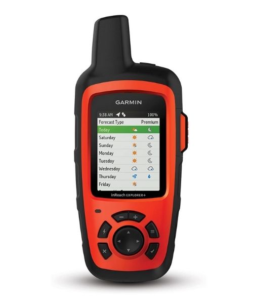
It's always good to bring a GPS tracker with you. We use the Garmin inReach.
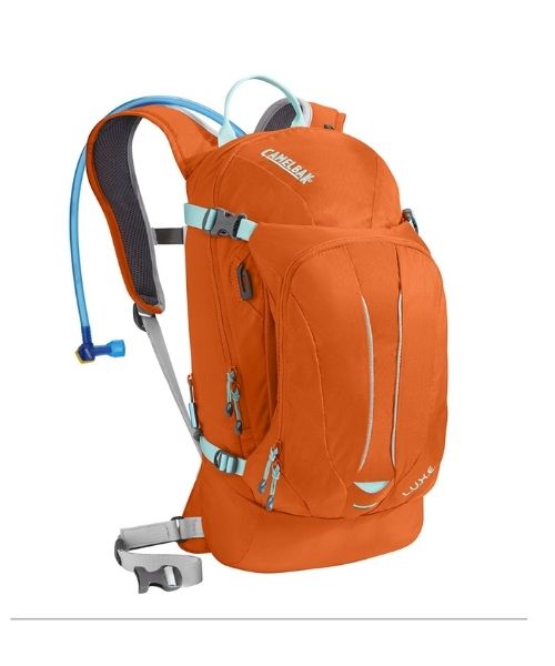
This is Vy's favorite hiking bag! It has tons of room for snacks and water!


Our favorite biodegradable, eco-friendly, reef-safe sunscreen!



This is our go-to camera for all of our adventures. It comes with us everywhere!
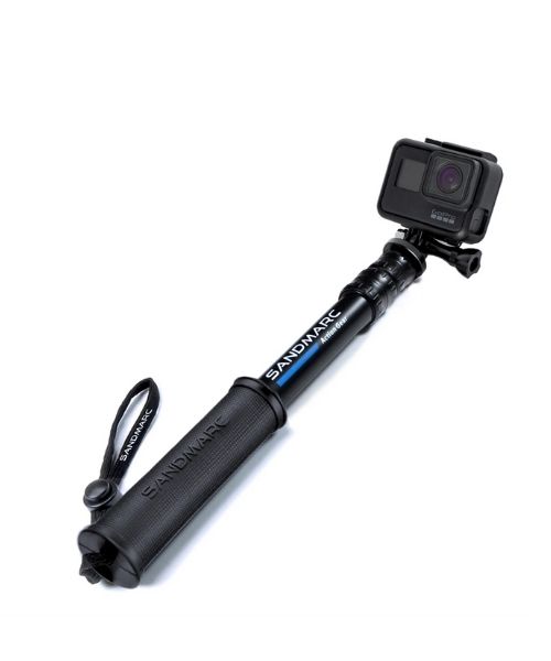
Compact GoPro pole that extends to 25", perfect to bring on your adventure.



Nice to meet you!
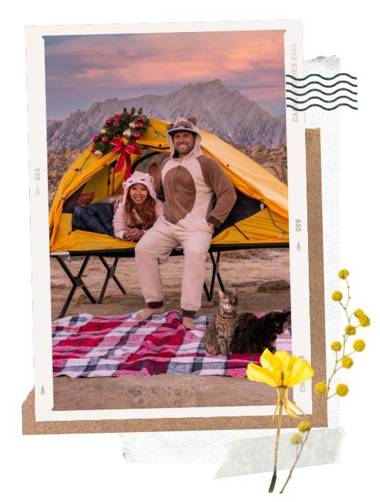
Hi! We are Dustin & Vy, the proud creators of Live That Adventure. We created this website because we wanted to inspire others to live their lives to the fullest. On here, you’ll find everything from hiking, canyoneering, kayaking, and snorkeling to adventure and travel tips, gear reviews, and bucket list items such as bungee jumping or wing walking. We’ll show you the ropes so you can do them too!
Subscribe
Get our best adventure tips, guides and more send to you!
Subscribe
Get our best adventure tips, guides, and more send to you!